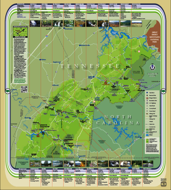
Almost two years in the making, but well worth the wait according to many folks! While there are various maps of the Cherokee National Forest, most prove less then “user friendly” when it comes to quickly finding just where a noteworthy feature is, and how to get there. We believe the brand new Adventure Map will help on both accounts.
The 650,000 acre national forest is divided into northern and southern sections. For each, specific features such as campgrounds, hiking trails, picnicking sites, water attractions, wilderness areas, toilet facilities, as well as vistas and scenic views, are displayed in an easy to follow format. GPS coordinates and QR code links are provided to help the smartphone users. U.S., State, County and Forest Service roads are clearly shown. Visit the CNF website for more information www.fs.usda.gov/cherokee.
Partners of the Cherokee NF is a non-profit organization, and map proceeds will directly benefit the Cherokee National Forest in carrying out its mission of caring for the land and serving people.


Comments by admin